
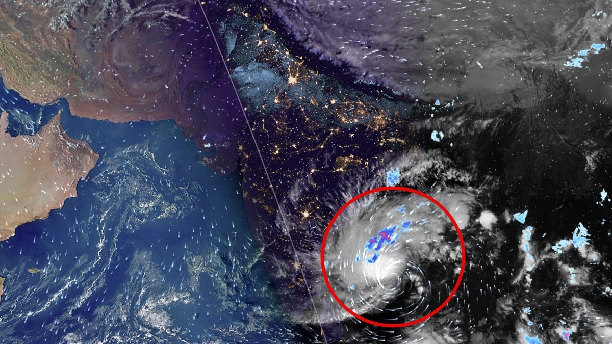
Isro satellites captured a massive cloud buildup as a Bay of Bengal system intensified. The forecast cyclone could become India's third within a month and trigger coastal alerts.Satellite images captured the massive cloud buildup over the southeast and adjoining southwest Bay of Bengal. (Photo: Zoom.earth)New Delhi,Nov 16, 2026 18:23 ISTIndia is bracing for another powerful cyclonic storm as a deep depression over the Bay of Bengal is forecast to intensify into a very severe cyclonic storm before making landfall along the Andhra Pradesh coast on November 20.This would be the third cyclone in less than a month to affect India, following Cyclone Arnab and Severe Cyclonic Storm Murasu earlier in November.Satellite images from India's INSAT-3DS and INSAT-3DR have captured the massive cloud buildup over the southeast and adjoining southwest Bay of Bengal, indicating intense atmospheric activity around the developing system. Photo: IMD The INSAT-3DS thermal infrared image, captured on November 16 between 5 pm and 5:27 pm IST, shows a large, dense cloud mass over the Bay of Bengal. Another image from INSAT-3DR, captured earlier between 4:15 pm and 4:42 pm IST, shows the extensive cloud bands associated with the system, spreading across large parts of the central and southern Bay of Bengal. According to the India Meteorological Department (IMD), the deep depression moved north-northwestwards at a speed of 17 kmph during the six hours preceding 11:30 am on November 16. It was centred over the southeast and adjoining southwest Bay of Bengal.At the time, the system was approximately 650 km east-southeast of Chennai, 730 km south-southeast of Visakhapatnam and 850 km south of Gopalpur in Odisha. Photo: IMD FROM DEEP DEPRESSION TO VERY SEVERE CYCLONEThe IMD has forecast rapid intensification over the coming days. The system is very likely to become a cyclonic storm over the central parts of the south and adjoining west-central Bay of Bengal by the evening of November 16.It is then expected to intensify into a severe cyclonic storm by the evening of November 17. Thereafter, it is likely to strengthen further into a very severe cyclonic storm as it moves west-northwestwards towards India's eastern coastline. The IMD has issued a pre-cyclone watch for Andhra Pradesh. (Photo: IMD) The cyclone is forecast to cross the Andhra Pradesh and Yanam coast between Nellore and Tuni around noon on November 20.At landfall, the system is expected to pack maximum sustained wind speeds of 120–130 kmph, with gusts reaching 145 kmph.COASTAL STATES ON ALERTThe IMD has issued a pre-cyclone watch for Andhra Pradesh and adjoining south Odisha coast, placing the region under a yellow message.With the system expected to intensify significantly before landfall, its movement, wind strength and rainfall distribution will remain crucial factors for coastal preparedness over the next few days.- Ends
Isro satellite captures powerful storm as third cyclone set to hit India
Full Article
Original Source
Read the full article at Indiatoday →KhanList aggregates and links to publicly available news content. We do not host full articles from third-party sources. Always verify important information with original sources.