
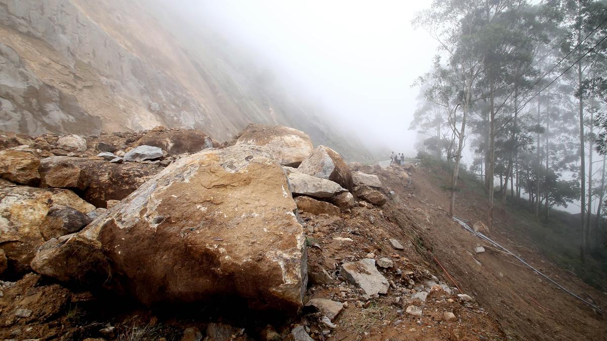
File photo of the landslip that occurred on the Gap Road stretch of the Kochi-Dhanushkodi National Highway, near Munnar, in Idukki. | Photo Credit: Sandeep Vellaram As heavy monsoon rains continue to trigger devastating landslides across the Western Ghats, an international research team has developed an automated early warning system to forecast slope failures in Idukki.Officials said researchers from the University of Mississippi, Michigan Technological University, and the University of Kerala developed the system. The study was published in a recent edition of the journal Environmental and Engineering Geoscience.K.S. Sajinkumar, associate professor at the Geology department of the University of Kerala, who associated with the study noted that the system — dubbed the Google Earth Engine-based Landslide Early Warning System, or GLEWS — combines real-time satellite data, weather forecasts and live ground-level rainfall measurements to issue color-coded public safety alerts.“Predicting landslides in mountainous terrain like Idukki has long been hindered by gaps in rainfall data. While satellites provide broad coverage, they frequently underestimate intense, localised downpours in rugged hills. Conversely, sparse ground weather stations cannot capture rainfall patterns across an entire district on their own. To address the issue, GLEWS blends multiple data streams on the Google Earth Engine cloud platform,” said the official.The system relies on three primary components — satellite and forecast data: it ingests three-hour precipitation measurements from NASA’s Global Precipitation Measurement mission alongside hourly rainfall forecasts from the Global Forecast System; live ground telemetry: it integrates real-time rainfall readings from eight automatic weather stations across the region. Using a mathematical technique called “conditional merging,” GLEWS calibrates the satellite data against actual ground-gauge observations to correct estimation errors; and terrain stability mapping: here, rainfall metrics are overlaid onto a high-resolution, 30-metre slope stability map that calculates a Factor of Safety. Areas with a rating of 1.5 or lower are flagged as highly susceptible to collapse, while zones above 2.0 are considered stable.Two major eventsTo test the system’s operational reliability, the research team evaluated GLEWS against two major landslide events in Idukki. “On the August 15, 2018 floods and landslides, uncalibrated satellite data and standard coarse gridded rainfall maps detected only 8.9% of landslide conditions. However, when GLEWS calibrated the data using point-level observations from just five India Meteorological department rain gauges, its detection sensitivity jumped to 72.6% — proving that localised ground measurements are indispensable for accurate warnings,” said Dr. Sajinkumar.“In a second-phase test analysing the July 7, 2023 landslide along the Gap Road stretch of Munnar, raw satellite data recorded a modest 20 mm of daily rainfall. After GLEWS applied its ground-gauge calibration, the estimated rainfall tripled to 63.9 mm, accurately reflecting the severity of the local downpour,” he said.“Originally prototyped in JavaScript, GLEWS has been ported to Python by the researchers to enable automated data ingestion from weather stations. This upgrade allows the system to run autonomously throughout Keralam’s intense monsoon seasons, offering disaster management authorities a scalable, real-time tool to issue timely evacuations and save lives,” added Dr. Sajinkumar. Published - November 21, 2026 06:00 am IST
International research team develops early warning system for landslides in Keralam’s Idukki
Full Article
Original Source
Read the full article at Thehindu →KhanList aggregates and links to publicly available news content. We do not host full articles from third-party sources. Always verify important information with original sources.