
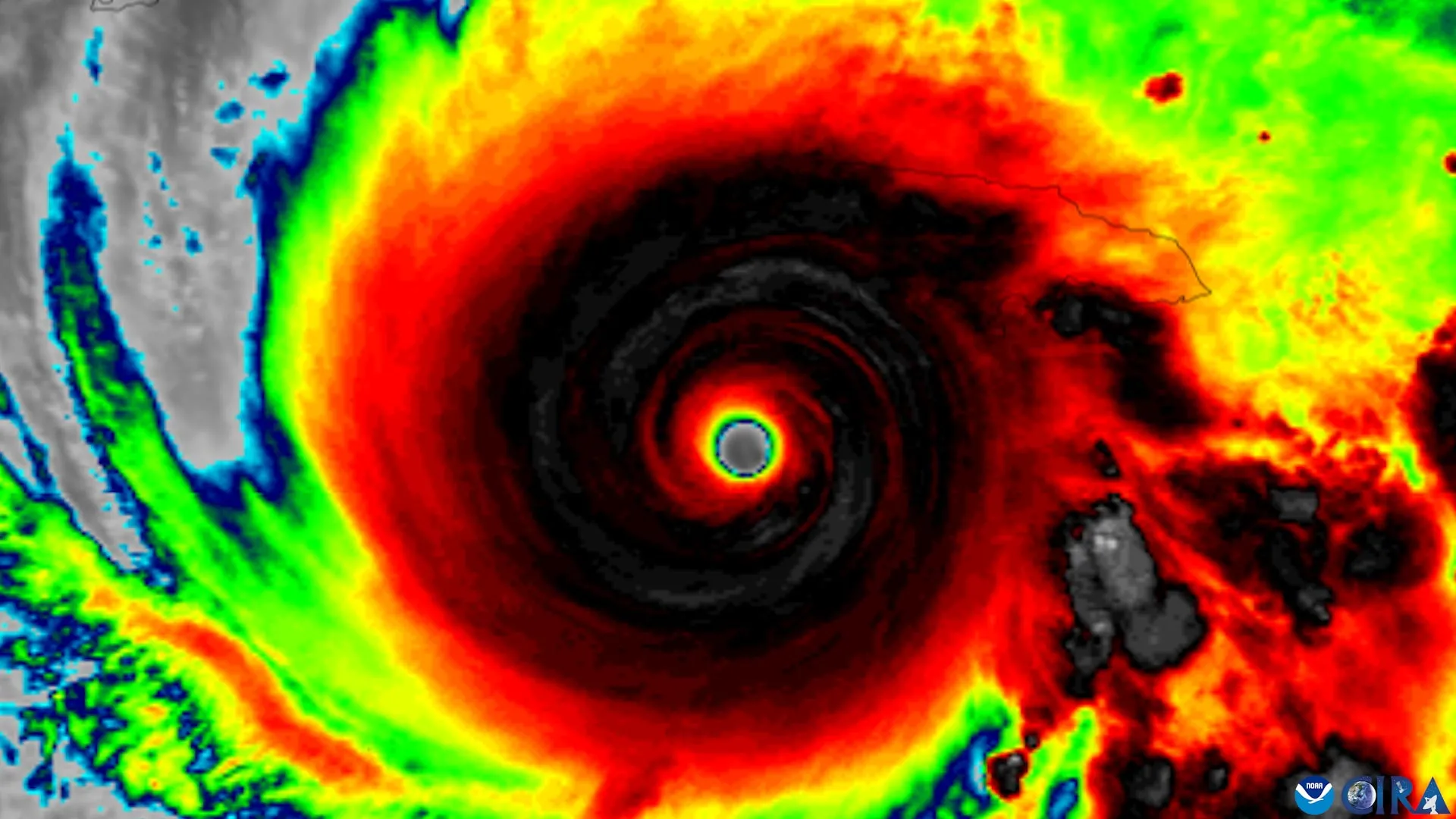
Tropical cyclones generally need to become vertically organized before they can grow much stronger. That means the storm's rotating centers at different levels of the atmosphere must line up rather than remain tilted away from one another. Using nearly three decades of observations from NOAA Hurricane Hunter aircraft, researchers have now identified four features that appear to help tilted tropical cyclones become vertically aligned and more capable of intensifying. The research was led by scientists at the University of Miami Rosenstiel School of Marine, Atmospheric, and Earth Science, working with colleagues at NOAA's Atlantic Oceanographic and Meteorological Laboratory. Their findings suggest that successful alignment depends on several factors working together, including the storm's internal structure, the direction of surrounding winds, and environmental conditions around the cyclone. Understanding this transition is important because rapidly intensifying storms can give coastal communities and emergency managers very little time to respond. If forecasters can recognize earlier when a poorly organized tropical cyclone is becoming more favorable for strengthening, they may be able to provide communities with additional time for evacuation decisions and other preparations. "A tropical cyclone has to stand up straight before it can intensify," said Michael S. Fischer, the lead author and an assistant professor in the Department of Atmospheric Sciences at the Rosenstiel School. "Strong winds higher in the atmosphere can push the top of a storm's circulation away from the center near the ocean surface. Until those centers come back together, the storm usually cannot intensify substantially." Four Signs That Favor Storm Alignment The researchers identified four characteristics that can help determine whether a tilted tropical cyclone is likely to straighten vertically. The first is a compact, tightly organized circulation close to the ocean surface. The second is a storm tilt positioned favorably relative to vertical wind shear. The third is stronger rising air and heavier rainfall near the storm's lower-level center. The fourth is an environment that includes warm ocean water, plenty of atmospheric moisture, and relatively weak winds in the middle levels of the atmosphere. Meteorologists use the term "tilt" to describe the separation between a tropical cyclone's circulation centers at lower and middle altitudes. Vertical wind shear refers to changes in wind speed or direction with height. Strong shear can interfere with a cyclone's organization by pushing the upper portions of its circulation away from the center closer to the ocean surface. Nearly Three Decades of Hurricane Hunter Data To investigate which storms successfully became aligned, the researchers examined data from the Tropical Cyclone Radar Archive of Doppler Analyses with Recentering, known as TC-RADAR. Developed by Fischer and colleagues, the database includes 1,510 radar analyses gathered by NOAA Hurricane Hunter aircraft across 28 hurricane seasons from 1997 through 2024. That extensive record allowed the team to compare storms that eventually became vertically aligned with those that remained tilted. "The storms that aligned already looked different about a day beforehand," said Fischer, who also is a core faculty member of the Frost Institute for Data Science and Computing. "They had stronger, more tightly wound circulations near the surface and more widespread, vigorous thunderstorms lifting air near that center. Our findings suggest those thunderstorms are not simply a sign of organization. They may also help pull the storm's leaning circulation upright." The findings suggest that thunderstorms developing near the lower level circulation may play a more active role in storm organization than simply serving as a visible sign that strengthening is underway. Earlier Clues That a Storm Is Becoming Organized NOAA reconnaissance aircraft already collect many of the measurements highlighted by the study during operational flights, including low-level wind strength, storm size, thunderstorm coverage, and the direction of a cyclone's tilt. That means the newly identified features could potentially help scientists evaluate whether high-resolution hurricane forecasting models are accurately reproducing the physical process that allows tilted storms to become vertically aligned. The research may also provide forecasters with additional clues about which disorganized tropical cyclones are beginning to transition into a structure that is more favorable for intensification. "Even a modest increase in forecast confidence a day earlier can provide more usable preparation time for communities in a storm's path," Fischer said. "This study gives us real-world evidence about what separates a storm that is becoming organized from one that remains tilted and less capable of strengthening." The study, "To Align or Not to Align? That Is the Question," was published in the Journal of Geophysical Research: Atmospheres. In addition to Fischer, the authors are George R. Alvey III of the Cooperative Institute for Marine and Atmospheric Studies and NOAA's Atlantic Oceanographic and Meteorological Laboratory; Deelan Jariwala, who earned bachelor's degrees in meteorology and mathematics from the University of Miami in spring 2026; and Paul D. Reasor of NOAA's Atlantic Oceanographic and Meteorological Laboratory Hurricane Research Division. The research was supported by the National Science Foundation under award No. 2241605.
Hurricane Hunters reveal 4 warning signs that a storm is about to strengthen
Full Article
Original Source
Read the full article at Sciencedaily →KhanList aggregates and links to publicly available news content. We do not host full articles from third-party sources. Always verify important information with original sources.