
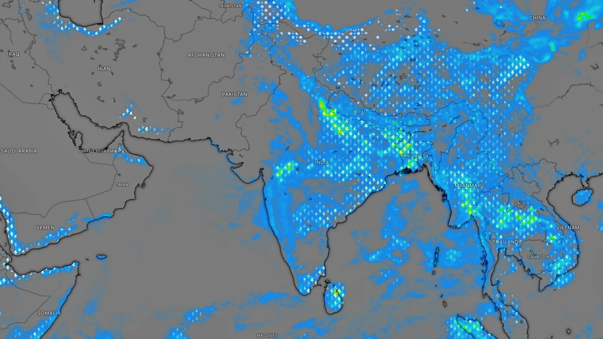
The IMD has warned of heavy rain across parts of North and East India on Tuesday as a low-pressure area sits over central Uttar Pradesh. The alert comes as multiple systems interact and the rain belt shifts towards eastern and northeastern regions.The IMD has also issued a warning for strong surface winds over Telangana, with wind speeds of around 30 to 40 kmph possible in some areas. (Photo: Windy)Several parts of North and East India are likely to remain under the grip of active monsoon conditions on Tuesday, September 8, with the India Meteorological Department (IMD) warning of heavy rainfall across multiple states.The weather system is being driven by a low-pressure area over central parts of Uttar Pradesh, along with the monsoon trough and multiple other atmospheric systems influencing weather across the country.According to the IMD, isolated heavy rainfall is likely over parts of East Madhya Pradesh, East Uttar Pradesh, Bihar, West Bengal, Odisha and several northeastern states on Tuesday.The warning comes after an intense spell of rainfall battered parts of northern India. Exceptionally heavy rainfall of more than 20 cm was recorded in West Uttar Pradesh, with Bareilly witnessing exceptionally heavy rain. Very heavy rainfall, between 12 and 20 cm, was also reported from parts of Uttarakhand, East Uttar Pradesh and Bihar. The low-pressure area, which was earlier located over southwest Uttar Pradesh and adjoining areas, has now shifted over the central parts of the state.The IMD said several other weather systems are also influencing conditions, including a trough associated with the low-pressure area, two western disturbances affecting the Himalayan region, and cyclonic circulations over northeast Bihar and parts of Assam.For Tuesday, rainfall activity is expected to remain concentrated over eastern and northeastern parts of the country.A yellow warning has been issued for several states, including parts of East Madhya Pradesh, East Uttar Pradesh, Bihar, West Bengal, Odisha and the northeastern region, indicating the possibility of heavy rainfall at isolated places.Meanwhile, parts of southern India are expected to experience a different weather pattern.Rainfall activity over the peninsula is likely to remain subdued over the next several days. However, hot and humid conditions are expected to continue over Kerala on Tuesday.The IMD has also issued a warning for strong surface winds over Telangana, with wind speeds of around 30 to 40 kmph possible in some areas.The broader weather outlook suggests that heavy rainfall activity could continue shifting towards East and Northeast India over the coming days.By September 9, heavy rainfall warnings are likely to cover Bihar, Chhattisgarh, Odisha, Jharkhand, Gangetic West Bengal, northeastern states and East Madhya Pradesh.Further ahead, Uttarakhand, Chhattisgarh, Kerala, East Madhya Pradesh and northeastern states could continue witnessing spells of heavy rain.For now, residents across rain-prone regions have been advised to remain alert as multiple weather systems continue to interact during the closing phase of the southwest monsoon.- EndsPublished By: Sibu Kumar TripathiPublished On: Sep 7, 2026 19:30 IST
Heavy rain alert for North, East India. New system to drive weather on Tuesday
Full Article
Original Source
Read the full article at Indiatoday →KhanList aggregates and links to publicly available news content. We do not host full articles from third-party sources. Always verify important information with original sources.