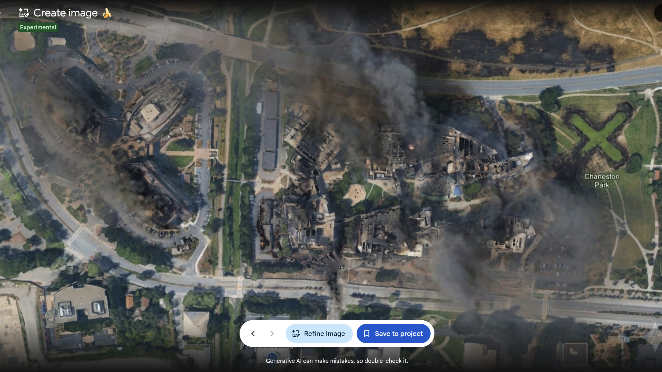
Previous Ars testing of Google’s SynthID system has shown that Google’s digital watermark can persist despite substantial image edits and data loss. However, Ars also encountered the issue of SynthID limiting image checks to about 10 per day. When Ars prompted Google’s Gemini app to run a SynthID check on several AI-modified images generated within Google Earth—before Google removed the Google Earth feature—Gemini responded that it had “detected digital watermarking indicating that part or all of this image was generated or edited using Google AI tools.” But Ess questioned why Google’s policy on preventing the creation of AI-generated images on harmful topics had not stopped him from depicting scenes such as a hospital with a bomb crater in Gaza. He also expressed skepticism about primarily relying on Google’s SynthID watermarking system and Google’s AI tools for verifying whether an image is AI-generated. “Fakes do not travel as clean files with their credentials intact,” Ess wrote. “They travel as screen recordings, re-encodes, screenshots of screenshots, filmed off somebody’s phone in a hurry.” Indeed, Google’s SynthID was unable to provide any image verification when Ars used a smartphone camera to take a photo of an AI-altered image made using the Google Earth feature. Undermining trust By introducing an AI image generator as a Google Earth feature, Google risked undermining public trust in Google Earth as a reliable reference for providing authentic imagery of the real world, Ess said. It could have also handed an additional excuse to government officials or anyone who wants to deny genuine satellite photos by claiming they were modified or generated entirely by AI tools. Giving anyone access to an easy tool to create AI-modified satellite imagery could have also made it even harder for journalists and researchers checking misinformation and disinformation. Ess recommended using multiple sources to verify satellite imagery and relying on constantly updated satellite imagery sources such as Europe’s Copernicus Sentinel-2. Google may have alleviated immediate concerns by deciding to quickly remove the AI tool within Google Earth—but its statement suggested that the company could eventually bring the feature back in the future. “We’ve seen geospatial professionals using this feature for a range of useful purposes, however we’ve also seen people sharing screenshots of generated imagery that appear to violate our policies,” according to the Google statement. “So we’re rolling back this feature in Google Earth while we work on implementing stronger guardrails.”
Google Earth risked ruin with retracted AI tool for making fake satellite pics
Full Article
Original Source
Read the full article at Arstechnica →KhanList aggregates and links to publicly available news content. We do not host full articles from third-party sources. Always verify important information with original sources.