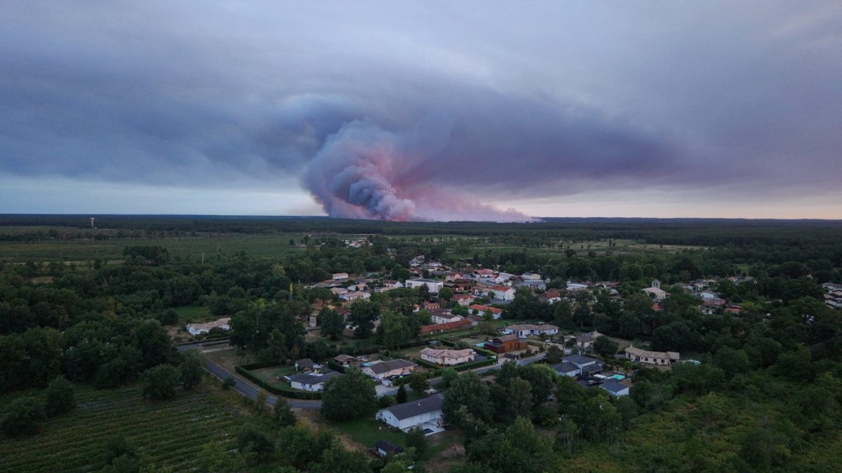
The forest fires currently raging near Bordeaux, in the south of France, have triggered a frightening new phenomenon – fire clouds, Also called pyrocumulonimbus, these form when blazes get so big they start triggering thunderstorms, lightning and unpredictable winds that can help spread the flames. “The formation of pyrocumulonimbus indicates that the fire is interacting strongly with the atmosphere and has begun to generate its own weather,” says Dr Francesca Di Giuseppe, fire forecast co-ordinator at the European Centre for Medium Range Weather Forecasts (ECMRWF) Shorts What makes these clouds form and why are they so dangerous? Ordinary summer thunderclouds form on hot days, when air close to the ground gets heated and rises into cooler air higher up, causing moisture to condense into tiny water droplets and ice crystals. When air gets heated by wildfires, it rises in a similar way, to form large cauliflower-shaped clouds called pyrocumulus, which may be white or grey from the smoke particles. There is plenty of moisture around because fire is a chemical reaction that produces water vapour. The more extreme pyrocumulonimbus develops if the heated air has enough force to push through a layer of the atmosphere called the capping inversion, which normally acts like a lid that stops thunderclouds from rising further. A fire cloud during the Fairview Fire in San Bernardino National Forest in California in 2022 (Photo: Patrick T Fallon/AFP) “If you can break through that ‘lid’, you get this towering effect,” said Dr Joe McNorton, a fire scientist at ECMRWF. The unprecedented pyrocumulonimbi were seen last week above the wildfires blazing in pine forests in the south west of France. The area has been affected by months of drought. They have previously been seen above wildfires in Australia and North America, and last year, for the first time, over Spain and Portugal – but this is thought to be the first time they have occurred in France. Both pyrocumulus and pyrocumulonimbus are a danger during wildfires – it is just a matter of degree. Worsening the fire’s spread The clouds are bad news because they can worsen the fire’s spread in several ways. The rising updrafts of air create convection currents that pull in air from other regions, which means the wind can quickly change in intensity and direction. “It’s really challenging for firefighters on the ground and at a level of planning evacuations,” says Dr Zakary Campbell-Lochrie, a fire scientist at the University of Edinburgh. A firefighter watches trees being consumed by flames near Marcheprime, outside Bordeaux, France (Photo: Emma Da Silva/AP) The strong winds can also pick up burning embers and deposit them several kilometres away, potentially starting new fires. Finally, just like regular thunderstorms, the pyrocumulonimbus may cause lightning, which can also spark new fires. “If the conditions are right elsewhere for a fire, all it needs is that ignition source,” adds McNorton. For all these reasons, firefighters get a lot more worried when they see these towering clouds, he said. “One of the firefighters who was working in Iberia said there was a change in feel around the firefighting crews when they started to witness this, because there’s the fear that it creates more erratic fire conditions. “And for the general public, it’s obviously a very intimidating sight.”
France is seeing its first severe ‘fire cloud’. This is why firefighters are worried
Full Article
Original Source
Read the full article at Inews →KhanList aggregates and links to publicly available news content. We do not host full articles from third-party sources. Always verify important information with original sources.