
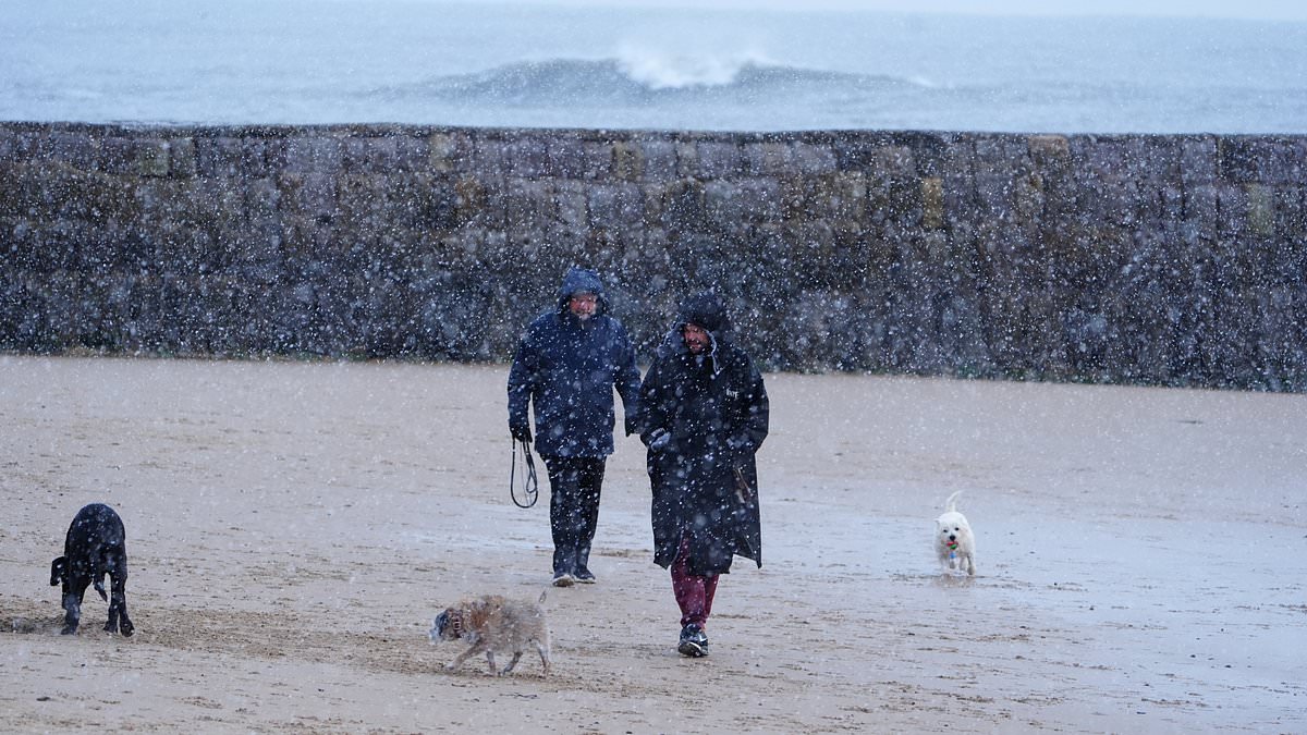
Published: 05:22 EST, 16 November 2026 | Updated: 05:51 EST, 16 November 2026 Britain experienced its first snowfall of autumn today with blizzards and 60mph winds on the way along with a cold health alert after the coldest night of the season.Flurries began on the coast of North East England this morning as photographs showed dog walkers and even swimmers braving the conditions at Cullercoats Beach.The Met Office has issued an 11-hour yellow warning for snow running from 12am to 11am tomorrow which stretches from the West Midlands to southern Scotland.A band of rain will head northwards through tonight and tomorrow morning which will likely turn to snow after it encounters colder air within the warning area.Locations at an altitude of 300ft (100m) or higher will mainly be affected, with any snow falling below this level expected to be temporary and quickly melting.Forecasters said in areas where snow does accumulate, depths of up to 2in (5cm) are likely with some locations above 1,000ft (300m) potentially seeing up to 6in (15cm).It comes after the UK's coldest night of autumn so far with the Tulloch Bridge weather station in the Scottish Highlands recording -7.7C (18.1F) early this morning.That made today the eighth consecutive day of sub-zero temperatures, with the daily lows over the past week being -4.5C, -7.2C, -6.6C, -4.6C, -6.2C, -4.3C and -2.6C. Dog walkers on Cullercoats Beach in North Tyneside this morning as snow begins to fall A swimmer braves the wintry conditions on Cullercoats Beach as she heads into the sea today The first snow of autumn fell this morning along the coast of North East England Forecasters have warned of potential travel disruption on higher level routes with the possibility of ice forming on infrastructure such as power lines.Met Office meteorologist Aidan McGivern said there will be an 'unsettled picture' from tonight. Sub-zero temperatures every day last week Monday: -2.6C; Capel Curig, WalesTuesday: -4.3C; Shap, CumbriaWednesday: -6.2C; Tyndrum, ScotlandThursday: -4.6C; Bridgefoot, CumbriaFriday: -6.6C; Sennybridge, WalesSaturday: -7.2C; South Newington, OxfordshireSunday: -4.5C; Santon Downham, Suffolk He said: 'It's during Monday evening that we're likely to see some freezing rain or snow over upland parts of mid to North Wales, rain at lower levels.'Then as that system moves into the colder air across northern England and southern Scotland during the early hours of Tuesday, we're likely again to see some significant and disruptive snow above 300m for northern England, above about 150 to 200m for southern Scotland.'That, accompanied by increasingly strong winds, we're talking about 50 to 60mph wind gusts, means that it is going to be hazardous for upland parts of northern England and southern Scotland, with the risk of drifting snow, ice accretion, and blizzards at lower levels.'He said while there could be a little snow at lower levels, it will likely turn back to rain by the start of the day, adding: 'And for where most people live, it will mostly be wet weather rather than wintry weather.'A yellow warning for ice was also in place across the north of England and Scotland until 10am today. Yellow cold health alerts have come into force in parts of the UK and will run until ThursdayThe Met Office warned of icy patches on some roads and pavements as well as injuries from slips or falls.The UK Health Security Agency (UKHSA) has also issued a yellow cold health alert for the North West, North East and Yorkshire and the Humber.These began at 9pm last night and will run until 9am on Thursday.The alerts mean weather conditions could result in an increased use of healthcare services and a greater risk to life for vulnerable people.Paul Coleman, consultant in Public Health at the UKHSA, said: 'This is the latest cold health alert of the season, and we can expect more as we move further into winter.'Cold weather can have a serious impact on the health of some people, including those aged 65 and over and those with pre-existing health conditions, so it is vital to check in on friends, family and neighbours who are most vulnerable.'Mr Coleman added that people should try to heat the rooms they use the most, if possible, and dress warmly during colder spells.
First snow of autumn! Flurries begin ahead of blizzards and 60mph winds after Britain's coldest night of the season as temperature drops to -7.7C
Full Article
Original Source
Read the full article at Dailymail →KhanList aggregates and links to publicly available news content. We do not host full articles from third-party sources. Always verify important information with original sources.