
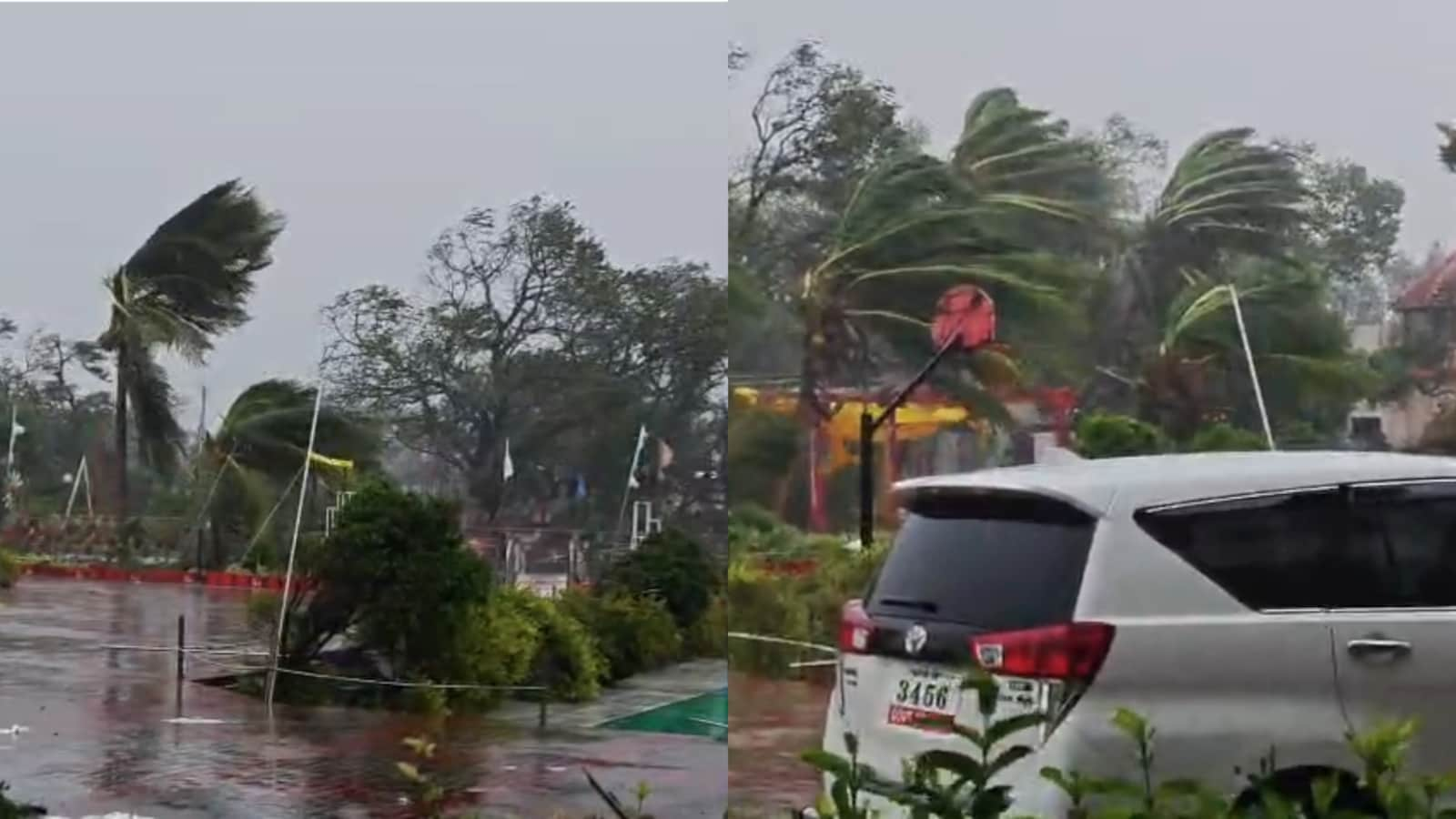
Severe Cyclonic Storm Murasu crossed the south Andhra Pradesh coast near Ongole in the early hours of Tuesday, leaving a trail of destruction across several coastal districts as heavy rain, gale-force winds and flooding disrupted normal life. Thousands of trees were uprooted, hundreds of electricity poles were damaged, fishing boats were damaged, standing crops suffered extensive losses and transport services were hit in several parts of the state.#WATCH | Ongole, Andhra Pradesh: The landfall process of Cyclone Murasu has started along the South Andhra Pradesh coast. Heavy rainfall accompanied by extremely strong gale winds is lashing the Kothapatnam Beach area near Ongole, with strong winds witnessed along the coastline as the cyclone makes landfall.— ANI (@ANI) November 3, 2026According to the India Meteorological Department (IMD), the cyclone crossed the coast between Nellore and Narasapur, close to Ongole, between 3:30 am and 5:30 am with wind speeds of 100-110 kmph gusting up to 120 kmph. Photo Credit: PTIThe weather agency said the system is likely to weaken into a cyclonic storm by noon and further into a deep depression by Tuesday midnight.The Severe Cyclonic Storm “Murasu” [Pronunciation: Murasu]” over Westcentral Bay of Bengal close to south Andhra Pradesh coast moved north-northwestwards with a speed of 08 kmph during past 06 hours, crossed south Andhra Pradesh coast between Nellore and Narasapur close to Ongole (near Latitude 15.53°N and Longitude 80.22°E) during 0330 to 0530 hours IST with the wind speed of 100-110 kmph gusting to 120 kmph, and lay centered at 0530 hours IST of today the 03rd November, 2026 over south coastal Andhra Pradesh, near Latitude 15.6°N and Longitude 80.2°E close to Ongole, about 40 km southwest of Bapatla (Andhra Pradesh), 80 km north-northeast of Kavali (Andhra Pradesh), and 120 km west-southwest of Machilipatnam (Andhra Pradesh) and 130 km north of Nellore (Andhra Pradesh). It is likely to continue to move North-northwestwards and weaken gradually into a cyclonic storm (wind speed reaching 80-90 kmph gusting to 100 kmph) by noon and further into a deep depression (wind speed reaching 55-65 kmph gusting to 75 kmph) by midnight of today, the 3rd November,2026. It is under the continuous surveillance of Doppler Weather Radars at Machilipatnam and Visakhapatnam.— India Meteorological Department (@Indiametdept) November 3, 2026Heavy rainfall and strong winds caused widespread damage to infrastructure and agriculture, while several low-lying areas came under sheets of water. Vehicles were stranded on national highways and motorists struggled to navigate through poor visibility as intense rain and gusty winds battered the region. The adverse weather conditions disrupted vehicular movement and left commuters stranded at several locations.The cyclone was centred roughly 30 km from Ongole, 50 km from Kavali, 70 km from Bapatla, 100 km from Nellore and 140 km from Machilipatnam. It had been moving north-northwestwards at a speed of 8 kmph during the previous six hours before making landfall.Red Alert Across Several DistrictsEven though the cyclone has crossed the coast, weather officials warned that the threat is far from over, with strong winds and heavy rainfall expected to continue through the day. The IMD has issued red alerts for Krishna, Guntur, Bapatla, Palnadu, Markapuram and Prakasam districts, where extremely heavy rainfall is likely at isolated places.Explaining the current situation, Dr Karuna Sagar of IMD Amaravati said the cyclone retained its intensity while crossing the coast and continued to pose risks due to heavy rainfall and strong winds."Looking at the radar image, we can see well-organised cloud clusters, which are currently affecting Bapatla, Prakasham, Krishna, NTR, and Guntur. Today, these areas are likely to experience heavy to very heavy rainfall, with isolated extremely heavy downpours. On the rainfall warning map, several districts are placed under a red alert, while neighboring districts like Nandyal, Nellore, Tirupati, Eluru, West Godavari, and East Godavari face heavy to very heavy rainfall in one or two places," he said.He added, "Although the system has crossed the coast, wind speeds are still maintaining 100 to 110 km/h, and it is gradually weakening, expected to weaken further into a depression by tonight. Because strong winds will continue to persist, there are risks of power lines and electricity poles getting damaged, trees and branches uprooted, and weak structures or buildings suffering damage. Continuous rainfall is expected, particularly heavy in Krishna, Guntur, and Vijayawada, with overflowing ponds and streams likely. Therefore, we advise the public to remain extremely cautious and stay indoors, as heavy rainfall and strong winds will continue, posing risks of travel hazards until official clearance is given by government authorities."#WATCH | Ongole, Andhra Pradesh: Heavy rainfall and strong gale winds trigger rough sea conditions, causing damage to thatched houses and uprooting trees in the region as cyclonic storm Murasu makes landfall near Kothapatnam. https://t.co/NehA1kxSEu— ANI (@ANI) November 3, 2026Andhra Pradesh Meteorological Department Director K Nagaratna also said the system was weakening but remained dangerous because of strong winds and heavy rain. She advised fishermen not to venture into the sea until Wednesday.Photo Credit: PTI"This severe cyclonic storm Murasu moved in a north-northwest direction and crossed the south coastal Andhra Pradesh coast near Ongole, around 15.53 degrees north latitude and 18.22 degrees east longitude, between 03:30 IST and 05:30 IST on 3 November, bringing gusty winds that reached 100 to 110 kilometres per hour, peaking at 120 kilometres per hour at times," she said.Bapatla Receives Highest RainfallThe cyclone triggered widespread rainfall across Andhra Pradesh, with Bapatla recording the highest district-average rainfall of 40.02 mm between 8:30 am on Monday and 5:00 am on Tuesday.Prakasam received 26.56 mm of rainfall, followed by West Godavari (23.36 mm), Krishna (23.15 mm), Guntur (19.09 mm) and Srikakulam (18.30 mm). Konaseema recorded 14.47 mm, Tirupati 12.37 mm and Kakinada 11.72 mm.Rainfall was particularly intense in parts of coastal Andhra. Kothapatnam in Prakasam district recorded 164.25 mm of rainfall between 10:00 pm Monday and 5 am Tuesday. NG Padu received 114.19 mm, Chirala in Bapatla 99.59 mm, Trovagunta 91.95 mm, Mogalturu in West Godavari 79.34 mm and Malkipuram in Konaseema 74.75 mm.The IMD has forecast heavy to extremely heavy rainfall over the next four days in Bapatla, Guntur, Krishna, Palnadu, NTR, Eluru and West Godavari districts. Moderate to heavy rainfall is also expected in East Godavari, Polavaram, Kakinada, Konaseema, Prakasam and Markapuram districts.Relief Measures UnderwayAuthorities have stepped up precautionary measures in vulnerable areas as the cyclone continues to weaken inland.NTR District Collector Lakshmisha said there were no major issues in the district so far due to Cyclone Murasu. However, some families had been shifted to relief camps as a precautionary measure because of possible landslides in Mogalrajapuram.With heavy to very heavy rainfall forecast, the Collector urged people to stay indoors, avoid unnecessary travel and keep children inside.Centre Assures SupportAs the state assessed the damage caused by successive cyclones, Union Home Minister Amit Shah spoke with Andhra Pradesh Chief Minister N Chandrababu Naidu about the situation.During the conversation, Chandrababu Naidu briefed Shah on the impact of Cyclone Arnab and Cyclone Murasu, including crop losses, property damage in several districts and ongoing relief and rescue operations.Spoke with the CM of Andhra Pradesh Shri @ncbn Ji about the impact of Cyclone Murasu. Assured him of every possible assistance from the Centre. NDRF and SDRF teams are already on the ground, helping those affected. Govt of India stands with people with an unwavering resolve. ఆంధ్రప్రదేశ్ ముఖ్యమంత్రి శ్రీ నారా చంద్రబాబు నాయుడు గారితో ఫోన్లో మాట్లాడి, మురసు తుఫాను ప్రభావంపై వివరాలు తెలుసుకున్నాను. కేంద్ర ప్రభుత్వం నుంచి అన్ని విధాలా సహాయ సహకారాలు అందిస్తామని హామీ ఇచ్చాను. ఇప్పటికే ఎన్డీఆర్ఎఫ్ (NDRF), ఎస్డీఆర్ఎఫ్ (SDRF) బృందాలు క్షేత్రస్థాయిలో సహాయక చర్యలు చేపట్టి, తుఫాను ప్రభావిత ప్రాంత ప్రజలకు అండగా నిలుస్తున్నాయి. ఎలాంటి పరిస్థితులనైనా ఎదుర్కొనే దృఢ సంకల్పంతో భారత ప్రభుత్వం ఆంధ్రప్రదేశ్ ప్రజలకు అండగా నిలుస్తుంది.— Amit Shah (@AmitShah) November 3, 2026The Chief Minister thanked the Centre for deputing a team to assess the damage and urged the Union Government to extend adequate financial assistance to Andhra Pradesh, which has been hit by back-to-back cyclones.Rail Services DisruptedThe cyclone also affected railway operations across Andhra Pradesh.Railway authorities halted or regulated train movements on the Vijayawada-Ongole-Gudur section. Seven trains were cancelled, the Pinakini Express was rescheduled by two hours and four long-distance trains were diverted through alternative routes.Odisha, Tamil Nadu Also Feel ImpactThe effects of Cyclone Murasu were also felt in neighbouring Odisha and Tamil Nadu.In Odisha, southern districts recorded light rainfall after the cyclone crossed the Andhra coast. Disaster Management Minister Suresh Pujari said district collectors in Koraput, Malkangiri, Kandhamal, Kalahandi and other districts had reported light rain.The state, however, remains on alert due to concerns over landslides in hilly areas."We are on high alert, and the people of the hilly terrain will remain in shelters for some time, keeping in view of the weather conditions," he said.More than 1.60 lakh people have been shifted to safety and disaster response teams have been deployed in five southern districts.Meanwhile, Tamil Nadu continued to experience intensified northeast monsoon conditions. Heavy rainfall, strong winds and rough sea conditions were reported in parts of northern Tamil Nadu and neighbouring Puducherry.#WATCH | Chennai, Tamil Nadu: The Severe Cyclonic Storm Murasu crossed the South Andhra Pradesh coast between Nellore and Narsapur, close to Ongole, between 0330 and 0530 hours IST today, with wind speeds of 100-110 kmph, gusting to 120 kmph. Visuals are from Marina Beach shows fishermen venturing into the sea.— ANI (@ANI) November 3, 2026The cyclonic system, which originated over the southwest and adjoining west-central Bay of Bengal, brought continuous rainfall to Puducherry from midnight.(With inputs from agencies)
Cyclone Murasu Crosses Andhra Pradesh Coast: Crops Damaged, Transport Hit
Full Article
Original Source
Read the full article at Ndtv →KhanList aggregates and links to publicly available news content. We do not host full articles from third-party sources. Always verify important information with original sources.