
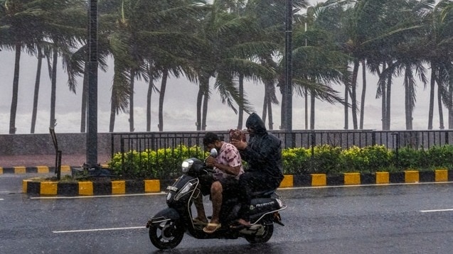
A weather system over the Bay of Bengal is likely to intensify into a cyclonic storm on Monday, November 16, bringing another cyclone threat to Andhra Pradesh and Odisha.Once it reaches cyclonic storm intensity, it will be named Cyclone Akvan.The India Meteorological Department (IMD) has warned of heavy to very heavy rainfall along the Andhra Pradesh coast on November 19 and 20, with isolated extremely heavy rainfall likely in north coastal Andhra Pradesh.The developing system could intensify further into a very severe cyclonic storm, with wind speeds reaching 120-130 kmph and gusts of up to 145 kmph, according to the IMD's forecast. The department has not yet specified an exact landfall location, but north coastal Andhra Pradesh and adjoining south Odisha are among the areas being closely monitored.The fresh threat comes after two cyclones, Arnab and Murasu, damaged standing crops across more than 4.5 lakh hectares in Andhra Pradesh. The storms also uprooted trees and disrupted power and communication networks, raising concerns about further damage.CYCLONE AKVAN TRACKER: WHERE IS THE SYSTEM NOW?The system developed from a low-pressure area over the southeast Bay of Bengal on November 13. It strengthened into a depression on November 15 and subsequently intensified into a deep depression.In its National Bulletin issued on November 16, the IMD said the system was centred over the southeast and adjoining southwest Bay of Bengal. It was located around 870 km south-southeast of Visakhapatnam and 760 km east-southeast of Chennai.The system is expected to move north-northwestwards and intensify into a cyclonic storm on Monday.It could become a severe cyclonic storm over the west-central Bay of Bengal on November 17 before strengthening further and moving towards the Andhra Pradesh coast over the following two days.The IMD's forecast indicates that it could reach very severe cyclonic storm intensity by November 19, with sustained wind speeds of 120-130 kmph and gusts of up to 145 kmph. However, the exact landfall location has not been announced.WHICH ANDHRA PRADESH DISTRICTS ARE LIKELY TO RECEIVE HEAVY RAIN?The IMD has forecast heavy rainfall at isolated places in coastal Andhra Pradesh on November 18.Rainfall is likely to intensify on November 19 and 20, with heavy to very heavy showers at a few places and isolated extremely heavy rainfall of 21 cm or more in north coastal Andhra Pradesh.Rayalaseema is also likely to receive heavy rainfall at isolated places on November 19 and 20.Districts likely to experience heavy rainfall include Srikakulam, Vizianagaram, Parvathipuram Manyam, Visakhapatnam, Alluri Sitharama Raju, Anakapalle, Kakinada, Konaseema, East Godavari, West Godavari, Eluru, Krishna and Bapatla. Parts of Nellore, Tirupati and Chittoor may also receive heavy rainfall.WHY WILL THE CYCLONE BE NAMED AKVAN?Akvan is the name contributed by Iran to the official list of cyclone names maintained under the World Meteorological Organization and United Nations Economic and Social Commission for Asia and the Pacific naming system.The name also appears in Persian mythology as Akvan-e Div, a character in the Persian epic Shahnameh. However, the official cyclone-naming list does not specify an English meaning for the name.The naming system for cyclones over the Bay of Bengal and Arabian Sea uses names contributed by 13 countries, including India, Iran, Bangladesh and Pakistan. The names are used in a predetermined sequence and are not repeated once assigned.The IMD's Regional Specialised Meteorological Centre in New Delhi assigns a name when a weather system reaches the prescribed cyclonic storm intensity. The names help meteorological agencies, governments and the public identify storms and communicate warnings clearly.ANDHRA PRADESH FACES ANOTHER CYCLONE THREAT AFTER CROP DAMAGEThe developing system has raised concerns in Andhra Pradesh, which is still dealing with the impact of cyclones Arnab and Murasu in late October and early November.According to a report by The Times of India, the two storms damaged standing crops across more than 4.5 lakh hectares.They also uprooted thousands of trees, snapped power lines and communication networks and damaged roads in coastal districts.The latest weather system could cause further losses, particularly in areas where farmers have already suffered damage from the previous storms.The IMD has advised fishermen not to venture into the southwest Bay of Bengal between November 16 and 19, the central Bay of Bengal between November 16 and 20, and the northwest Bay of Bengal on November 19 and 20.Sea conditions along the Andhra Pradesh coast are also expected to deteriorate.The IMD has forecast phenomenal sea conditions from the evening of November 19 into the morning of November 20.- Ends
Cyclone likely to form over Bay of Bengal today, IMD issues alert for Andhra, Odisha
Full Article
Original Source
Read the full article at Indiatoday →KhanList aggregates and links to publicly available news content. We do not host full articles from third-party sources. Always verify important information with original sources.