
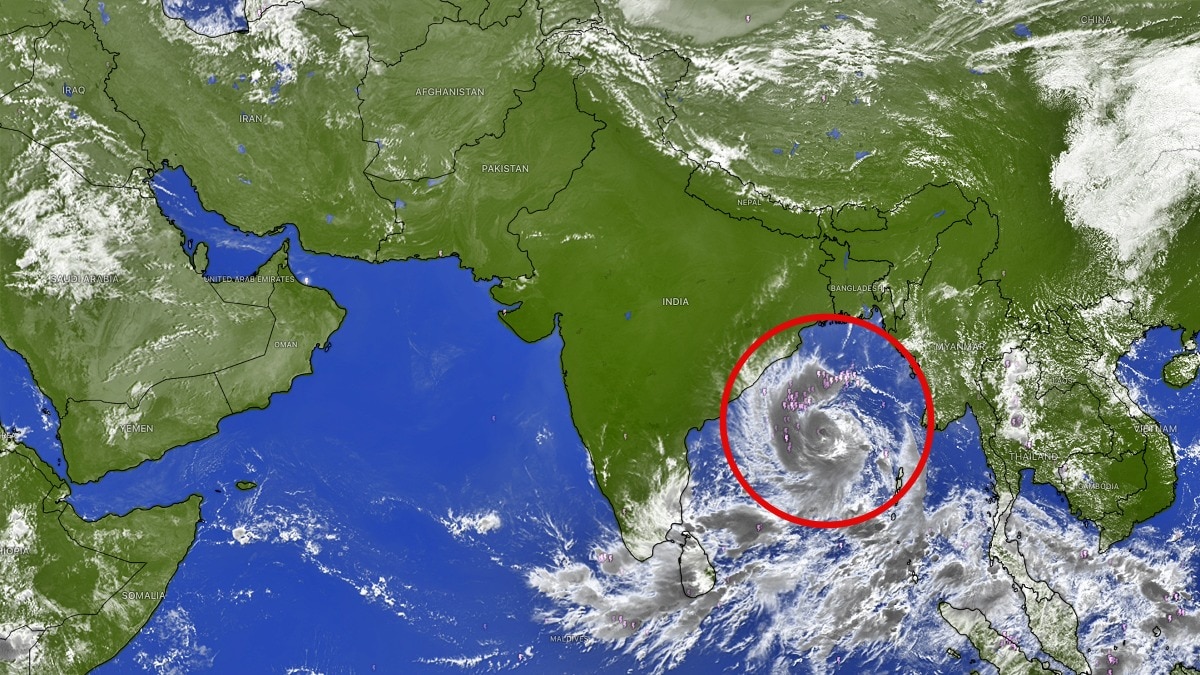
Deep depression intensifies into cyclone, IMD warns it will turn into severe stormCyclone Arnab's projected intensification over the next two days could significantly increase the threat to the eastern coastline. (Photo: Windy)New Delhi,Oct 26, 2026 10:34 ISTCyclonic Storm Arnab over the Bay of Bengal is expected to intensify into a severe cyclonic storm by midnight on October 26 and further strengthen into a very severe cyclonic storm on October 27, the India Meteorological Department (IMD) warned on Monday.The weather system is likely to cross the Andhra Pradesh and Yanam coasts between Bapatla and Visakhapatnam, close to Yanam, by the forenoon of October 28, 2026, as a very severe cyclonic storm, with maximum sustained wind speeds of 115-125 kmph and gusts reaching 140 kmph.Issuing a red-level cyclone warning for the Andhra Pradesh and adjoining south Odisha coasts, the IMD said the system had intensified from a deep depression into Cyclonic Storm Arnab, pronounced 'Ornab'.CYCLONE ARNAB'S CURRENT POSITIONAccording to the IMD's latest bulletin issued at 5.30 am IST on October 26, Cyclone Arnab was centred over the east-central and adjoining west-central Bay of Bengal. The cyclone was located approximately 610 km southeast of Gopalpur in Odisha and 650 km east-southeast of Visakhapatnam in Andhra Pradesh. It was also about 730 km east-southeast of Kakinada, 830 km east of Machilipatnam and 910 km east of Bapatla.The system moved westwards at 15 kmph over the preceding six hours before intensifying into a cyclonic storm. The IMD said Arnab was very likely to move west-northwest and intensify further over the west-central Bay of Bengal before turning northwest.ANDHRA PRADESH BRACES FOR CYCLONE LANDFALLThe forecast landfall on October 28 places the Andhra Pradesh coastline in the potential path of a powerful cyclone, with adjoining south Odisha also under warning.The expected wind speeds of 115-125 kmph, gusting to 140 kmph, indicate the potential for damaging winds along the coast and in areas affected by the storm. The cyclone's eventual impacts will depend on its precise track, intensity and the conditions prevailing at landfall.The IMD's red alert signals the need for heightened preparedness along the vulnerable coastline as the system continues to strengthen.Authorities and residents in potentially affected areas should closely follow official weather bulletins and advisories as the cyclone approaches. Fishing and coastal activities should be guided by instructions issued by the relevant authorities.CYCLONE EXPECTED TO STRENGTHEN RAPIDLYCyclone Arnab's projected intensification over the next two days could significantly increase the threat to the eastern coastline. The IMD expects the storm to become severe by midnight on October 26 and very severe on October 27.The next updates on the cyclone's movement, wind speeds and likely landfall area will be crucial in determining the extent of the threat to Andhra Pradesh and neighbouring coastal regions.- Ends
Cyclone Arnab to hit Andhra, IMD warns it will intensify into a severe storm
Full Article
Original Source
Read the full article at Indiatoday →KhanList aggregates and links to publicly available news content. We do not host full articles from third-party sources. Always verify important information with original sources.