
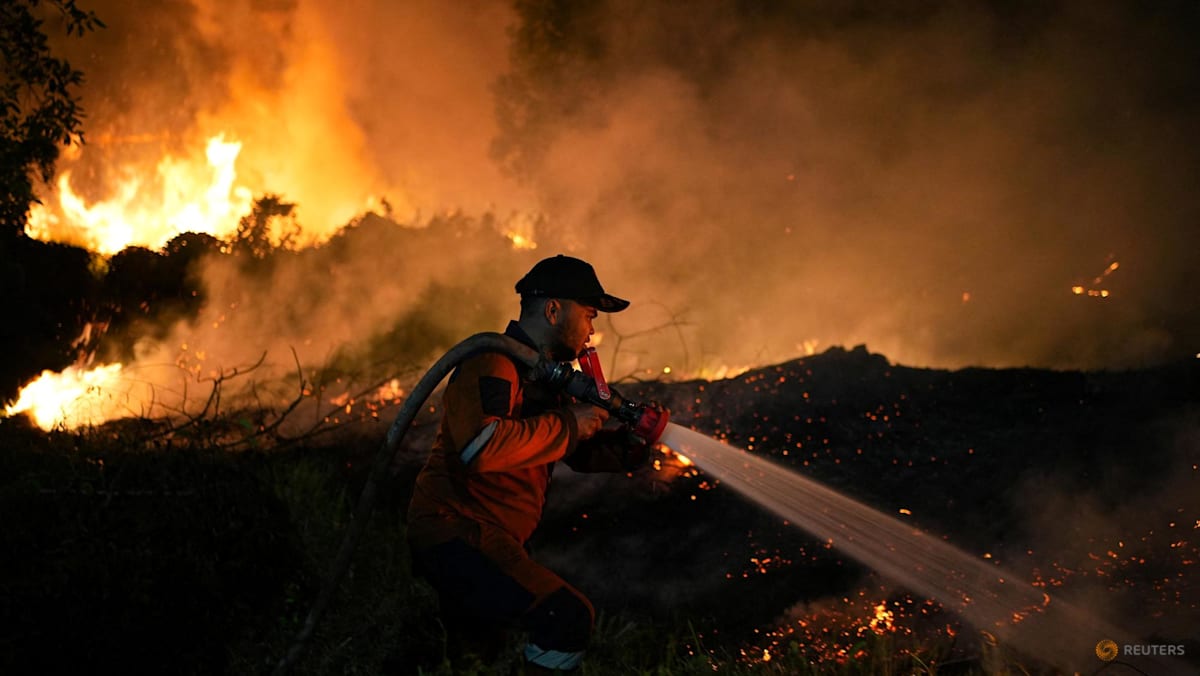
JAKARTA: Haze caused by fires that have raged for weeks in Indonesia’s Kalimantan and Sumatra has spread to neighbouring Malaysia, Brunei and as far as the Philippines, causing air quality to spike to hazardous levels in places like Serian in Malaysia’s Sarawak state. Tens of thousands of people have reported respiratory illnesses, schools were temporarily closed in parts of Sarawak, and 1.4 million students in six Indonesian provinces were shifted to online learning. Flights have also been disrupted in places like Pontianak in West Kalimantan.Indonesian authorities have responded by revoking the business permits of companies suspected of ordering the burning, and carried out joint cloud seeding operations with Malaysia, among other measures.But the region may not have seen the worst. September will be a crucial month, Indonesia’s Forestry Minister Raja Juli Antoni has cautioned, saying meaningful rainfall may not return until early October.“So this month is our battleground,” he said on Aug 31.CNA looks at how this year’s situation compares to previous years, what could lie ahead and what more needs to be done. A boy reacts as smoke rises from wildfires at a residential area in Ogan Ilir, South Sumatra province, Indonesia, Sep 2, 2026. (Photo: Reuters/Abriansyah Liberto) How bad are the fires compared with previous years? About 202,000 hectares – an area nearly three times the size of Singapore – in Indonesia was burnt between January and July this year, according to its Ministry of Forestry. Data for August and early September is not yet available, but the ASEAN Specialised Meteorological Centre said on Friday (Sept 4) that “moderate smoke plumes were ... observed to emanate from hotspots in the southern parts of Kalimantan and the southern and central parts of Sumatra.”. While more severe than recent years, the scale of Indonesia’s forest and land fires so far this year remains well below that seen in 2015, when the country experienced one of its worst fire crises. Fires torched about 2.6 million hectares in 2015, with roughly 600,000 hectares burnt between January and July that year. The 2015 fires blazed for more than three months and released 1.75 billion tonnes of greenhouse gas equivalents, according to the United States’ National Aeronautics and Space Administration Earth Observatory.As of Sep 2, Indonesia's 2026 fires have released roughly 10 per cent of the greenhouse gas equivalents of the 2015 fires, it said. Of the 202,000 hectares that have been burnt by the end of July, nearly half of it – or about 94,539 hectares – occurred in July alone, according to the Ministry of Forestry.Of particular concern this year is how quickly the fires have spread as El Nino conditions, which bring hotter and drier weather to the region, coincide with Indonesia’s dry season. Indonesia’s Meteorology, Climatology and Geophysics Agency (BMKG) has forecast the dry season to peak in August and September.This year's fires are, however, more severe than that of recent years as well as 2019, another El Nino year. Between January and July 2019, Indonesia recorded 137,000 hectares burnt.“It has already surpassed 2023 and 2019, but with El Nino conditions that are nearly similar to those in 2015, it is still below that level,” Raja Juli said at a working meeting with an Indonesian House of Representatives commission on Aug 18.Where are the fires, and what is driving them? Like in 2015, the areas that have seen the most extensive fires are Kalimantan and Sumatra. This year, however, fires have also spread to less typical areas including parts of Papua.South Papua, particularly the Merauke area, has emerged as a new epicentre, according to Yosi Amelia, climate and ecosystem programme lead at Indonesian climate and sustainability non-profit Madani Berkelanjutan.“South Papua, or Merauke, is a new forest and land fire hotspot. We strongly suspect this is linked to land clearing in food estate and energy project areas,” Yosi told CNA.Environmental groups have also pointed to peatland degradation as a factor behind the fires in South Papua.Peatlands are naturally wet ecosystems and do not typically burn under undisturbed conditions. But when drained, they may combust and the fires may burn beneath the ground surface for extended periods, generating much more fine particulate matter and carbon than tropical forest fires.“The drying and conversion of peatlands have contributed significantly to forest and land fires in South Papua,” said Wahyu A Perdana, advocacy, campaign and communication manager at Pantau Gambut, a non-governmental organisation focused on peatland research and conservation.Raja Juli said on Sep 1 that most of the fires in Kalimantan and Sumatra were almost certainly deliberately set by individuals or companies for various purposes, news outlet Jakarta Globe reported.An Environment Ministry official said on Aug 31 it is inspecting 19 companies linked to fires in Sumatra and Kalimantan. "We will investigate whether the fires started accidentally or were deliberately set. However, regardless of the cause, strict liability applies whenever a fire occurs within a concession area," said Rizal Irawan, a senior official at the country's Environment Ministry, as reported by Reuters.Rizal did not name the companies or disclose the type of concessions they hold. He added that the government will continue to investigate the remaining 23 companies facing fire risks, Reuters reported. Could conditions get worse?Raja Juli has called September a critical month, saying meaningful rainfall may not return until early October.“September is when we are at the peak. Hopefully, we will start seeing rain this month. Still, we just heard from BMKG that there may only be potential for rain in early October,” he said, as quoted by state news agency Antara on Aug 31.BMKG expects hot and dry conditions to persist into early September, with high-confidence hotspots concentrated mainly in Kalimantan. Experts have also warned that the fires are unlikely to subside in September, with some saying the country may not yet have reached the peak of this year’s fire season.Herry Purnomo, a researcher at the Center for International Forestry Research (CIFOR) and a professor at IPB University, said current figures did not yet reflect the likely peak, with the high-risk fire period potentially stretching over the next several months.“This is not the peak. We are only in August. We still have September, October and November, and it usually starts to decline in December and January,” Herry told media outlet Katadata on Aug 28. Smoke rises from a wildfire burning in Palangka Raya, Central Kalimantan province, Indonesia, Aug 14, 2026. (Photo: Reuters/Ajeng Dinar Ulfiana) Forest fire expert Bambang Hero Saharjo of IPB University had an even starker warning. Prolonged drought and strong El Nino could produce conditions reminiscent of the devastating 1997-1998 crisis if the current escalation continues, he said.By area burnt, the 1997-1998 crisis was substantially larger than 2015. Indonesia's disaster management agency BNPB has said fires affected about 9.7 million hectares in 1997-1998, compared with about 2.6 million hectares in 2015. Some parts of Indonesia have yet to enter their most fire-prone period, Bambang said, as the dry season is expected to be longer and drier than usual.WALHI, a civil society organisation that advocates for the environment, recorded 6,902 hotspots between Aug 25 and 31, with Kalimantan having the highest concentration at 5,201 hotspots. This situation has caused the Air Pollution Standard Index in West Kalimantan and Central Kalimantan to consistently fall into the “unhealthy” to “hazardous” categories over the past week.WALHI’s analysis of satellite imagery also indicates that nearly 50 per cent of the hotspots are located within the operational areas of corporations in the forestry and oil palm plantation sectors. Indonesian Muslims offer mass prayers for rains, as haze from wildfires blankets the area, at the Mujahidin Grand Mosque in Pontianak, West Kalimantan province, Indonesia, Aug 29, 2026. (Photo: Reuters/Victor Fidelis Sentosa) What more needs to be done?While El Nino may be increasing the risk of forest and land fires in Indonesia – as well as in Europe and North America – the climate phenomenon alone does not explain why the problem keeps recurring, according to Herry of IPB University.Human activity and land management remain key factors, he said.Efforts have also largely focused on firefighting and law enforcement, rather than preventing fires or addressing their underlying causes, said Yosi Amelia of Madani Berkelanjutan.“What needs to change is the way we view forest and land fires themselves. They should not be seen simply as fire disasters, but also as symptoms of broader problems in forest and landscape governance, spatial planning, licensing, water management and the relationship between communities and the land,” Yosi said.Wahyu of Pantau Gambut emphasised the need for law enforcement to reassure the public and stakeholders that matters are being taken seriously.The government has investigated 42 concession-holding companies, imposed administrative sanctions on six and named two companies as suspects.Indonesia's disaster management agency, BNPB, will deploy some of its 48,000 officers to guard certain areas and prevent new fires being ignited, its spokesperson Berton Panjaitan was quoted as saying by Reuters on Aug 31. Passengers queue to board an airplane at Supadio International Airport, as haze from wildfires blankets the area and disrupts some flights, in Kubu Raya, West Kalimantan province, Indonesia, August 28, 2026. (Photo: REUTERS/Willy Kurniawan) The government has also deployed 34 aircraft to conduct water bombing operations, but their flights have been disrupted by thick haze and poor visibility, as well as limited water availability near the locations of the fires.Indonesia's Transport Ministry has also issued special permits for 35 foreign aircraft to enter the country's airspace and beef up its aerial firefighting capabilities, Reuters reported.Forestry Minister Raja Juli said the broader response combines law enforcement with weather modification, water bombing, ground operations and community-based prevention.He stressed that preventing forest and land fires requires collective effort and policy support to implement effective prevention measures.“With technical collaboration, fair law enforcement and growing public awareness, we are optimistic that we can get through this high-risk period successfully.”
CNA Explains: Why Indonesia’s forest fires could get worse and what needs to change
Full Article
Original Source
Read the full article at Channelnewsasia →KhanList aggregates and links to publicly available news content. We do not host full articles from third-party sources. Always verify important information with original sources.