
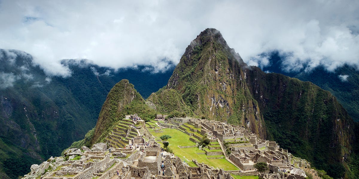
2 min readHere’s what you’ll learn when you read this story:A new archaeological discovery at Machu Picchu deepens the site’s connections to the sacred Mandor Wall.A team of researchers discovered 1.5 miles worth of roads connecting the site to additional terraces and platforms.Officials are keeping the exact location of the new discovery under wraps to prevent any amateur treasure hunters from disturbing the site.Archaeologists recently discovered 1.5 miles of pre-Columbian era roads leading to platforms and terraces near the Mandor Wall alongside Machu Picchu, buried under dense tropical forest. The Inca roads—nearly 8,000 feet high in the towering Andes—lead to a mixture of architectural features directly opposite Machu Picchu, further linking the larger complex together and showcasing the importance of the site. “This discovery complements and significantly revised hypotheses regarding the functioning of the entire complex,” Mariusz Ziółkowski, the director of the Center for Andean Studies at the University of Warsaw, said in a statement.A UNESCO World Heritage Site, Machu Picchu was “probably the most amazing urban creation of the Inca Empire at its height,” according to UNESCO, with giant stone walls, terraces, and ramps created to look as though they’d been cut naturally in the continuous rock escarpments. “The natural setting,” according to UNESCO, “on the eastern slopes of the Andes, encompasses the upper Amazon basin with its rich diversity of flora and fauna.”Within the larger Machu Picchu National Park, over 60 archaeological monuments connect via a network of roads. “These sites served various satellite functions in relation to the main complex, known as Llagta de Machu Picchu,” Ziółkowski said. “They are situated mainly on the left bank of the river, and it seemed that this was where the Incas has concentrated their urban planning efforts.”The newly discovered roads sit on the opposite side of the river, showing that a larger area “underwent significant cultural transformations during the Inca period.” Adding new roads to the mix further highlights just how the site functioned 600 years ago, and presents a fresh lens through which experts can view Machu Picchu.The discoveries come thanks (in large part) to LiDAR imagery, which helps map environments, even ones covered in dense vegetation, without on-the-ground exploration. The team hopes to hit the field next year to mine the details of what they spotted remotely through excavation, which should help define the size and scope of the platforms and may uncover additional architectural features. The team also hopes to accurately date the new discoveries next year.In the meantime, neither the Warsaw researchers nor the Peruvian government is sharing the exact location of the find, so as to keep amateur treasure hunters away.The links to a variety of new sites near the Mandor Wall shows that the sacred function of the larger Machu Picchu site covered a wider area than previously believed. One .75-mile section of discovered road features a common Inca zigzag design, prompting experts to believe that they could find proof that the road dates to the time of Machu Picchu’s use.Tim Newcomb is a journalist based in the Pacific Northwest. He covers stadiums, sneakers, gear, infrastructure, and more for a variety of publications, including Popular Mechanics. His favorite interviews have included sit-downs with Roger Federer in Switzerland, Kobe Bryant in Los Angeles, and Tinker Hatfield in Portland.
Archaeologists Scanned Machu Picchu—And Found Hidden Roads the World Had Never Seen Before
Full Article
Original Source
Read the full article at Popularmechanics →KhanList aggregates and links to publicly available news content. We do not host full articles from third-party sources. Always verify important information with original sources.