
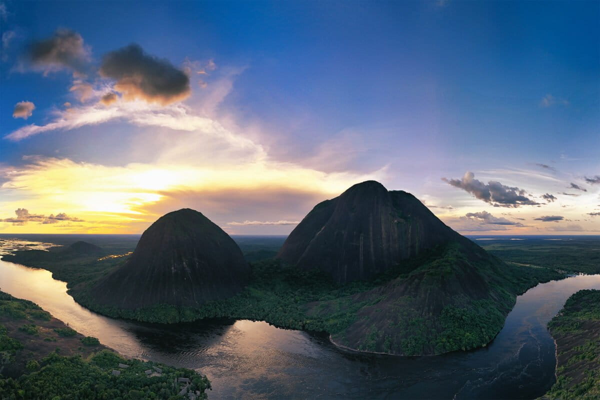
I had been struck by photographs of the Cerros de Mavicure rising above the forest and the Inírida River in eastern Colombia. The dark rock, exposed against an almost unbroken expanse of green, seemed unlike anywhere else I had visited in the Amazon. Last month, ahead of Mongabay Latam’s PUMA FEST in Bogotá, I finally had the chance to visit. I traveled with Daniela Quintero Díaz, Mongabay Latam’s investigations editor, and Oilber Díaz, a member of the Puinave people who guided us through the region. The three main hills, Mavicure, Mono and Pajarito, are outcrops of the Guiana Shield. They span two Indigenous territories. Mavicure, the hill visitors climb, lies within El Venado, while Mono and Pajarito are within El Remanso. Each territory has a nearby community of the same name. The hills are regarded as sacred by Indigenous peoples in the region. In Puinave tradition, they are connected to stories of creation, animals, family, and the rules governing relations between people and the natural world. Cerros de Mavicure. Image by Rhett A. Butler/Mongabay. Dreyk, a member of the Cubeo people from the Venado community, led us up Mavicure. The trail crossed steep granite, with forest growing in narrow seams and pockets of soil. From higher ground, the scale of the landscape became clearer. The hills rose abruptly from the canopy, while the Inírida curved around them. We reached a viewpoint in time for a beautiful sunset. On the descent after dark, frogs and geckos appeared along the trail. Cerros de Mavicure at sunrise. Image by Rhett A. Butler/Mongabay. The following morning offered a completely different scene. Wisps of cloud moved across the hills, at times obscuring their summits. Eventually, low clouds settled between them, creating the appearance of islands rising above a white sea. Much of the trip was spent on rivers. They are the main routes through the region, connecting Inírida with communities, forests, fishing grounds, and places of cultural importance. Visitors depend on local residents for boats, lodging, food, and guidance. Travel by water makes clear how closely life here is organized around seasonal changes in river levels. The muddy Guaviare River meeting the blackwater Atabapo River. Image by Rhett A. Butler/Mongabay. A boat navigating the meeting of the waters. Image by Rhett A. Butler/Mongabay. The rivers were unusually high. Although this is normally the peak flood season, local residents said the water was near the upper end of what they could remember. During the dry season, Oilber told us, parts of the Inírida can narrow to about six meters, revealing white-sand beaches that draw visitors. These waterways are also increasingly exposed to illegal gold mining and the mercury contamination that comes with it. Mavicure. Image by Rhett A. Butler/Mongabay. The area’s conservation history also reflects the importance of Indigenous authority. When the nearby Estrella Fluvial de Inírida Ramsar site was being planned, some Indigenous communities opposed proposed boundaries that overlapped their territories, concerned that an outside designation could weaken their control over land they had long managed. The Cerros were ultimately left outside the final Ramsar boundary. Their protection now depends largely on Indigenous territorial governance, national forest-reserve rules, and community efforts to manage tourism. The central issue was who would define conservation and govern the territory. Banner image: Cerros de Mavicure at sunset. Image by Rhett A. Butler/Mongabay. Credits Topics
Among the sacred hills of Colombia’s Guainía
Full Article
Original Source
Read the full article at News →KhanList aggregates and links to publicly available news content. We do not host full articles from third-party sources. Always verify important information with original sources.