
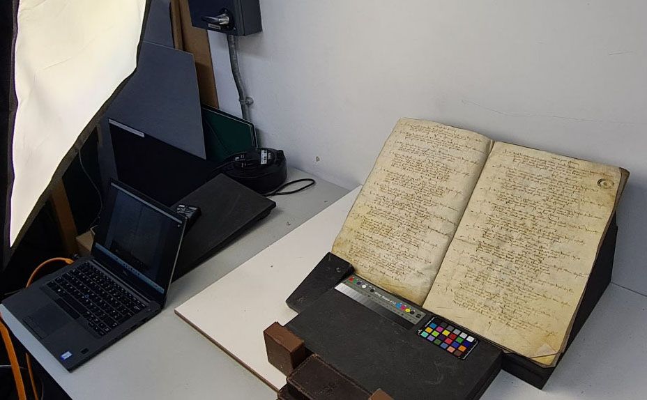
Using AI to comb through hundreds of thousands of handwritten pages of port records, historians have constructed an interactive map of Britain’s maritime trading routes. Even as it expanded in Asia and the Americas, Britain’s commerce with Europe remained overwhelming October 20, 2026 2:34 p.m. Researchers used artificial intelligence to read through old British port records. University of Southampton The British Empire was undoubtedly global. Beginning in the 16th century, its economic dominance was made possible, in large part, by maritime merchants and business-minded seafarers. By force, deals and persuasion, it built a vast network of overseas colonies, connecting the isle to distant shores and its people with coveted commodities, including tea from India, sugarcane from Jamaica and tobacco from Virginia. But new research suggests that a reliable web of shorter routes within Britain and with other European countries accounted for a significant majority of the nation’s trade—more than its colonies across the globe—as its empire grew between the late-16th and mid-18th centuries. Between 1696 and 1697, for example, a whopping 80 percent of the value of Britain’s global trade was generated by European markets. “It’s interesting to note that even centuries ago, Europe was Britain’s principal overseas trading region, and although Britain had important global connections, most of its core trade was still being done closer to its own shores,” John McAleer, a historian at the University of Southampton and the project’s co-lead, says in a statement. The project’s findings—published in a first-of-its-kind searchable online database—chart the empire’s growth and trade according to the data stored in hundreds of thousands of pages of port books, handwritten customs records of British ships, routes, destinations and cargo from 1565 onwards. An example of a handwritten document being transcribed by AI University of Southampton Researchers used artificial intelligence (AI) to help comb through the vast contents of the delicate parchment pages stored in the British National Archives. They trained software to decipher port officials’ unique handwriting styles, identify idiosyncratic notations and adapt to how the spelling of certain words changed over time. “Without AI extracting and organizing the data, this would have taken years,” Craig Lambert, a historian at the University of Southampton and the project’s lead researcher, says in the statement. “It still needed manual checking, but it sped up the process enormously.” In the maritime database, users can search for specific routes by ship name, commodity, port of origin, destination or year, and then trace the visual outline of the exact routes that vessels once followed on a digital map produced by the university’s GeoData Institute. Analysis of these records revealed a bustling network of more than 3,000 ports across the world, including more than 1,000 domestic ports in Britain. A plurality (426) were located in southwest Britain and another 306 were found on the southeastern coast. But every maritime location played an important role. Those in Hull and Whitby, for example, on England’s eastern shores, were critical trading posts for exchanges with the Netherlands and Scandinavia. “The Baltic is rich in grain, but it’s also rich in timber,” Lambert says in a video. “And that’s what the British need in vast quantities for the shipbuilding programs that they’re undertaking in this period.” Mapping historic documents into maps using AI Ports located further north, including Newcastle and Sunderland, were key nodes in the coal trade, which powered the Industrial Revolution. Coal was the most commonly traded commodity that the researchers analyzed, appearing in more than 101,000 cargo entries. Malt, wheat, iron, wool and wine were the next-most popular goods. “Much of England’s shipping was not engaged in glamorous long-distance voyages to the Americas or Asia,” Lambert tells the London Times’ Rhys Blakely. “Coastal shipping was fundamental to the economy, carrying coal, grain and other essential commodities between English ports.” Did you know? Global empire At its peak in the 1920s, the British Empire controlled over 25 percent of the land on earth. Over the roughly 200-year timeframe the researchers analyzed, British ships connected with 157 maritime sites in France, 68 in the Netherlands and 59 in India. Overall, of Britain’s top 15 trading partners by number of recorded maritime locations, 10 were on the continent. Still, the more unique imports that appear in the ledgers—children’s toys from China, exotic animal skins and Venice treacle, an ancient medicine believed to cure nearly any ailment—hint at the empire’s globalizing reach. You Might Also Like Get the latest stories in your inbox every weekday. More about: Artificial Intelligence British History Economics England Historians History Maps New Research Oceans Ships Trade
A Vast New Database Shows How Britain Built a Global Empire by Trading Goods Like Coal, Wine and Wood Closer to Home
Full Article
Original Source
Read the full article at Smithsonianmag →KhanList aggregates and links to publicly available news content. We do not host full articles from third-party sources. Always verify important information with original sources.