
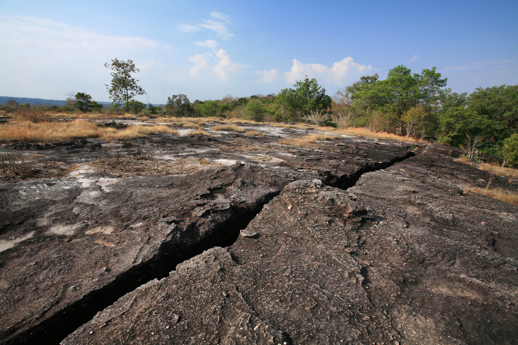
In April 2017, a magnitude 6.5 earthquake struck eastern Botswana, shaking a part of Africa that geologists thought was among the least likely places to experience such activity. The earthquake occurred deep inside the Kalahari Craton, an ancient block of continental crust containing rocks up to 3.7 billion years old, similar to other ancient geological formations that preserve clues to Earth’s earliest history. Now, a new study suggests that the craton is being pulled apart along a geological fracture that first opened roughly 180 million years ago. The old rift went dormant, but the forces stretching eastern Africa appear to be reactivating it, raising questions about how continents break apart and whether even their oldest foundations are as stable as scientists once believed. A failed rift gets a second chance Continental rifts form when tectonic forces pull a landmass in opposite directions, stretching and thinning its crust. If the process continues, the continent can eventually split, allowing an ocean to develop between the separating landmasses. However, these fractures usually develop in younger, weaker geological regions rather than ancient cratons, whose thick, cold and rigid interiors resist deformation. Researchers have also investigated how deep forces within Earth influence continental rifting. The new research work challenges this expectation. Published in Tectonics, the study identifies an active rift extending into the Kalahari Craton, at the southern end of the East African Rift System. “The earthquake happened in the middle of the craton, a region where no one expected to have an active fault slipping, let alone an active plate boundary developing,” Folarin Kolawole, one of the study authors and a geologist at Columbia University, said. Earlier investigations of the 2017 earthquake had already suggested that the East African Rift System extended nearly 320 kilometers (200 miles) beyond its previously recognized southern limit in northern Botswana’s Okavango Rift Zone. The new study investigates how this extension is developing and whether the structures responsible for it existed long before the recent earthquakes. Reading the rocks Rift zones in East Africa. Source: Kgosidintsi et al. The researchers concentrated on the Khurutshe Fault, which produces an approximately 80-kilometer-long (50-mile) scarp across Botswana’s otherwise relatively flat landscape. The ground on one side of this geological step rises as much as 120 meters (400 feet) above the other. Similar ancient faults can remain hidden beneath landscapes, making geological mapping important for identifying their activity. To investigate what was happening underground, the team dug trenches across the fault and examined excavations made for a government water pipeline. They also used electrical resistivity tomography, a technique that sends electrical currents through the ground and measures how different underground materials resist them. The researchers combined these images with records from 20 groundwater boreholes. The imaging revealed three main geological layers. The uppermost, approximately 10 meters thick, consists of relatively young Holocene Kalahari sediments. Beneath it lies an approximately 80-meter-thick, highly discontinuous Jurassic unit containing basalts and siliciclastic rocks. The deepest layer is the much older Precambrian basement. Both the young sediments and Jurassic rocks thicken toward the fault, suggesting that the ground on one side had dropped and created space for sediment to accumulate. The trenches provided further clues: researchers found hard Jurassic sandstone containing networks of white calcite veins deposited by hot fluids moving through cracks. Polished and scratched rock surfaces also recorded earlier movement along the fault. Together, the evidence points to an initial phase of rifting during the Jurassic Period, around 180 million years ago, when parts of the continent were being stretched. Faulting began before Jurassic volcanic activity reached the area, suggesting that rising magma did not initiate the original fracture. The rift subsequently became inactive before the East African Rift System began pulling on the region again. The fault has also displaced younger Kalahari sands deposited mostly within the last 2.6 million years, indicating that movement has resumed in relatively recent geological history. Exactly when the reactivation began remains unknown. “We believe Khurutshe is one of the failed Mesozoic rifts within the craton and is reactivating,” Boniface Kgosidintsi, first author of the study and a researcher at Botswana International University of Science and Technology, said.. The cracks beneath ancient rock The discovery also offers clues about why the rift developed where it did. Instead of creating an entirely new fracture, the stretching appears to have exploited an ancient geological seam where the oldest pieces of the Kalahari Craton joined billions of years ago. “While cratons are regarded as strong old continental blocks, they do have inherent zones of weakness that can localize a new plate boundary,” Kolawole said. He adds that reactivating these structures repeatedly may be necessary before a continent can finally break apart. “Maybe you need to reactivate the rift multiple times. You need to try multiple times before it actually succeeds.” Could Africa’s plates split further? The findings could also change how scientists understand the tectonic arrangement of southern Africa. Some researchers have proposed that the region forms a relatively stable microplate called the San Plate. However, the newly identified active rift suggests this supposedly coherent block may already be separating into two smaller pieces, which the researchers call the North San Plate and South San Plate. “We cannot assume that the plate is coherent,” Kolawole said. That does not mean a new ocean is about to appear. GPS measurements indicate that southern Africa’s rifts are spreading much more slowly than more developed sections of the East African Rift System in Malawi, Kenya and Ethiopia. Some rifts never progress beyond their initial stages and eventually become inactive again. The East African Rift’s ongoing tectonic activity offers another example of the forces gradually pulling the continent apart. Any potential breakup would take millions of years, if it happens at all. Scientists still need to establish how the reactivated fault is evolving, how much further the rift may extend and whether the slowly developing fracture can eventually become a fully developed plate boundary. Nevertheless, studying this early stage could help scientists understand where future plate boundaries develop and how continents eventually divide. As Kolawole puts it, “These systems are like cracks breaking through continents, and they will determine the location and the axis of a future ocean,” he said. The study is published in the journal Tectonics. Get the latest in engineering, tech, space & science - delivered daily to your inbox.Rupendra Brahambhatt is an experienced writer, researcher, journalist, and filmmaker. With a B.Sc (Hons.) in Science and PGJMC in Mass Communications, he has been actively working with some of the most innovative brands, news agencies, digital magazines, documentary filmmakers, and nonprofits from different parts of the globe. As an author, he works with a vision to bring forward the right information and encourage a constructive mindset among the masses.
A 180-million-year-old crack is reopening inside one of Earth’s oldest continents
Full Article
Original Source
Read the full article at Interestingengineering →KhanList aggregates and links to publicly available news content. We do not host full articles from third-party sources. Always verify important information with original sources.