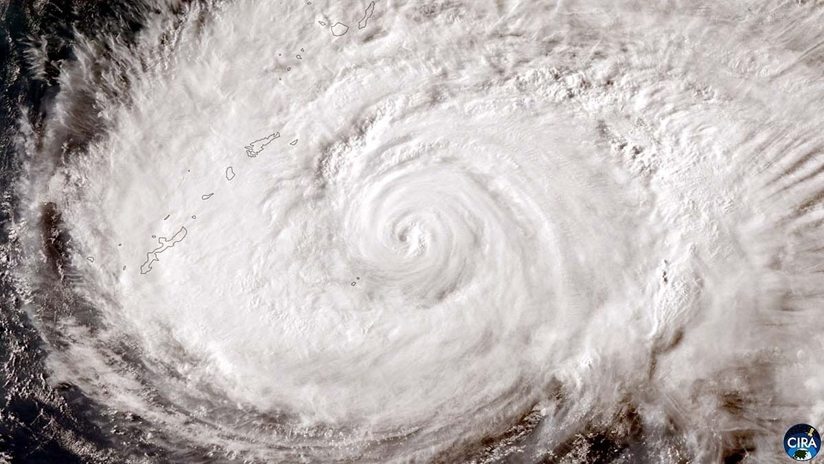
Typhoon Dolphin has lashed Japan's Okinawa islands, leaving five people injured and around 14,000 buildings without power as the powerful tropical cyclone continues its westward journey towards China.By 8:30 am IST on Saturday, August 8, Dolphin was about 160 km northwest of Kume Island in Okinawa and moving northwest at 15 kmph, according to Japan's Meteorological Agency (JMA), possessing maximum sustained winds of 162 kmph, with gusts reaching 216 kmph.The storm's passage disrupted life across southern Japan, with more than 500 flights cancelled on Friday, and authorities ordering evacuations for nearly 2,60,000 people across Okinawa and Kagoshima prefectures. A car makes its way through strong winds and rain as Typhoon Dolphin approaches. (Photo: Reuters) HOW DID TYPHOON DOLPHIN FORM?Dolphin began as a tropical disturbance over the western Pacific and developed into a tropical storm on July 27. The typhoon rapidly intensified over warm ocean waters, eventually reaching super-typhoon strength on July 30, with winds of about 270 kmph.Like other tropical cyclones, Dolphin drew energy from warm ocean water. Heat and moisture from the sea fuel thunderstorms around the storm's centre, allowing the system to strengthen when atmospheric conditions are favourable.Dolphin has weakened considerably from its peak but remains capable of producing destructive winds, intense rainfall and dangerous coastal conditions as it approaches China.Eastern parts of the country could receive exceptionally heavy rain through August 12, with some areas of Zhejiang forecast to receive more than 600 mm.Japan, on the other hand, is already facing the consequences.OKINAWA BATTERED, CHINA PREPARESDolphin's strong winds caused injuries in Okinawa, although the five people hurt were not reported to have life-threatening injuries.The storm also knocked out electricity to thousands of buildings. Trees sway in strong winds as Typhoon Dolphin approaches. (Photo: Reuters) China is now preparing for the next major phase of the storm as Dolphin is expected to reach the country's eastern coast between late Sunday, August 9, and early Monday, August 10.The typhoon will likely make landfall between Zhoushan in Zhejiang province and Fuding in Fujian province.Authorities in Zhejiang have raised the coastal typhoon alert to the highest level, shut ports and suspended 162 passenger ferry routes.Shanghai's Yangshan port has also been cleared of vessels.China has activated a level-three emergency response, while schools and tourist sites have been closed in parts of Zhejiang.Taiwan has cancelled 63 international flights as the storm approaches, although evacuations had not been ordered there.- EndsPublished On: Aug 8, 2026 12:00 IST
500 flights cancelled, 2.5 lakh evacuations: How did Typhoon Dolphin form?
Full Article
Original Source
Read the full article at Indiatoday →KhanList aggregates and links to publicly available news content. We do not host full articles from third-party sources. Always verify important information with original sources.