
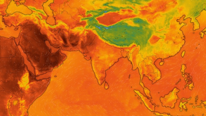
El Nino has strengthened sharply across the tropical Pacific and is expected to become a very strong event later this year, with the World Meteorological Organisation (WMO) putting the likelihood of it continuing through February 2027 at 100%.The warning goes beyond persistence.WMO officials said the event could potentially become the strongest El Nino observed since modern monitoring began, if the current warming trend continues through the end of the year.The latest WMO update, issued on September 3, marks the first time the organisation has expressed such a high level of confidence about an El Nino event. An aerial view of a barren land in Karauli, Rajasthan.(Photo: PTI) The organisation added that exceptionally warm ocean conditions are supporting further strengthening of El Nino, with the climate impacts likely to continue well into 2027.PACIFIC OCEAN CONTINUES TO BOILEl Nino is a natural climate pattern involving unusually warm waters across the central and eastern tropical Pacific, accompanied by changes in the atmosphere. Those changes can shift rainfall and temperature patterns far beyond the Pacific.The ocean is already showing just how unusual this event is.El Nio is firmly established and will intensify into a very strong event in the coming months. WMO forecasts show ~100% likelihood that it will persist through February 2027.A very strong El Nio same impacts everywhere.WMO El Nino Update: https://t.co/KUPq04jjkT pic.twitter.com/PAx1EZTCOH— World Meteorological Organization (@WMO) September 3, 2026The Nino 3.4 region, a key area used to monitor El Nino, was 1.5°C warmer than average from May to July 2026 and 2°C above average in July.Weekly values then rose to roughly 2.2°C to 2.6°C above average in late July and mid-August.The heat below the surface is even more alarming.In some parts of the tropical Pacific, subsurface temperatures were more than 8°C above average during July and early August.Together, these conditions are giving El Nino room to strengthen further. So much so that WMO expects it to reach very strong intensity and peak towards the end of 2026.El Nio is predicted to become the strongest ever observed in September, beginning a six-month run at record strength with a peak of +4.15°C.That's according to the new CanSIPS model update, which also suggests that La Nia is possible during the second half of 2027. pic.twitter.com/3lEagOZH4S— Ben Noll (@BenNollWeather) August 31, 2026The scale of the warming already puts the current event in rare territory. According to the WMO, it is one of only four El Nino events to fall into the “very strong” category in records dating back to 1950.A PROBLEM FOR INDIA?El Nino does not produce the same weather everywhere, and its strength alone cannot determine how severely a particular country will be affected.For India, however, it is an important climate signal because El Nino can influence the southwest monsoon and bring dry conditions.Historically, El Nino has often been associated with weaker monsoon rainfall, although the relationship is not absolute and other factors can alter the outcome. A farmer checks his crops at a partially dried up paddy land. (Photo: PTI) India's 2026 monsoon was already forecast by the India Meteorological Department to be below normal, and it has been that so far.In its updated May forecast, IMD projected seasonal rainfall at 90% of the long-period average, with a 60% probability of deficient rainfall.Aligning with the grim forecasts, India ended August staring at 16% rainfall deficit.If that wasn't bad enough, WMO's latest outlook also points to above-normal temperatures across almost all land areas during September-November, while warning that rainfall patterns will vary by region.A positive Indian Ocean Dipole (IOD) is also expected to develop, potentially modifying the usual effects of El Nino over India. A patch of a warm Pacific Ocean is captured by a satellite image. (Photo: Windy) A CLIMATE WARNINGThe effects could also extend beyond individual weather events.WMO officials said El Nino is expected to leave a temporary “pulse” in global temperatures in its wake, raising the possibility that 2027 could become the warmest year on record.The current record is held by 2024.A very strong El Nino can increase the likelihood of extreme heat, drought and floods in different parts of the world, but it does not mean every region will experience the same effect.You're looking live at El Nio going "full-tilt" to start meteorological fall. Once in a lifetime event.Three monster hurricanes in E. Pacific w/Hawaii splitting the uprights.Moisture from Hurricane Marie is going to inundate U.S. desert Southwest with major monsoon! pic.twitter.com/WN6G8gM2ra— Ryan Maue (@RyanWeather) September 1, 2026The significance of the latest forecast is therefore less about one particular weather event and more about the duration of the climate disturbance.With El Nino now expected to persist into early 2027, governments and weather agencies are being urged to strengthen preparedness for its potentially far-reaching effects.WMO has said that national meteorological agencies are stepping up early-warning and preparedness efforts, particularly for climate-sensitive sectors such as agriculture, health, energy and water resources.El Nino is a natural cycle. But as the world continues to experience record warmth, its arrival adds another layer of pressure to an already warmer climate.- EndsPublished On: Sep 3, 2026 16:12 IST
100% chance that supersized El Nino will last until early 2027, WMO warns
Full Article
Original Source
Read the full article at Indiatoday →KhanList aggregates and links to publicly available news content. We do not host full articles from third-party sources. Always verify important information with original sources.